Unique Roof Measuring Service
GeoEstimator – Safe & Inexpensive Roof Measurements
 Recently I stumbled upon a very cool new service for the construction industry that really caught my eye. GeoEstimator is a service that measures roof dimensions using satellite and aerial photography. They have a sophisticated software system that helps them create a report that includes all the major roof dimensions necessary for estimating roof construction and repair projects.
Safe & Accurate Measurements
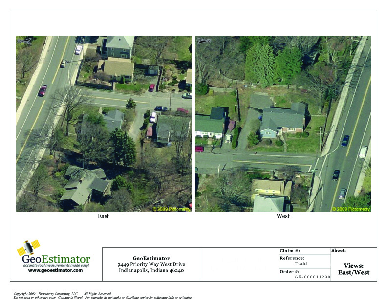
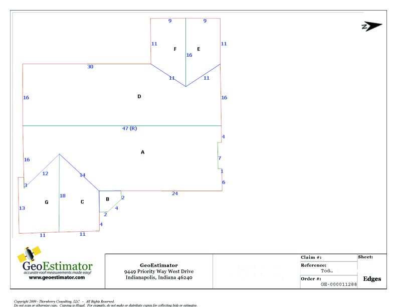
Measuring roofs can be time consuming, dangerous and typically not very accurate on complex roofs. This new service does all the work from the safety of an office desk using satellite and aerial photos. I was curious about how accurate the service is so I had GeoEstimator run a sample report for my first home in Massachusetts. I received an eight page report containing satellite and aerial photos of my old home along with several drawings defining all of the roof surfaces.
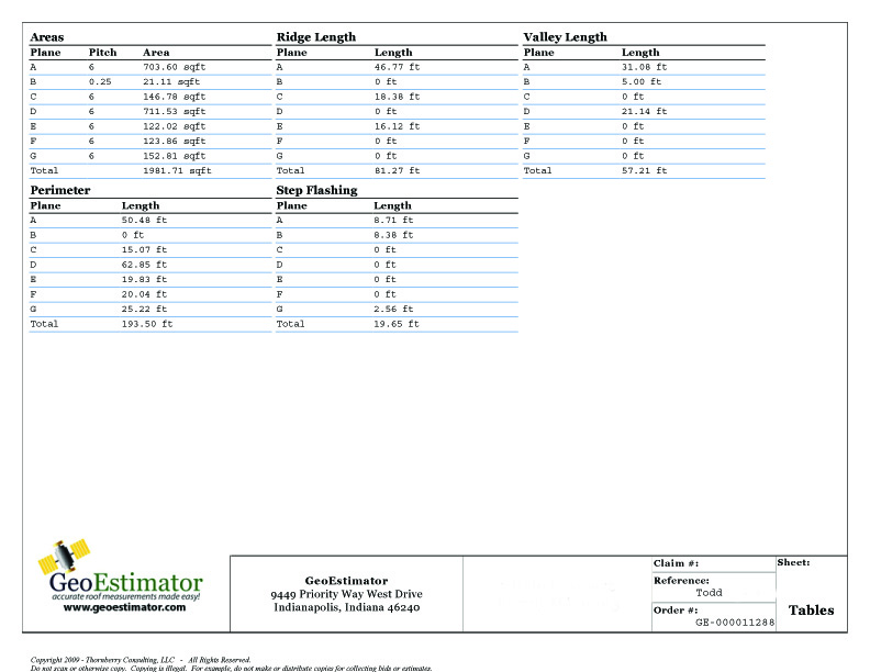
Below are samples from the report. As you can see you get several aerial photos of the subject building along with several drawings showing all the areas, lengths and roof pitches (I’ve only shown some of the pages of the report). Needless to say I was very impressed with the accuracy and thorough report that I received.
Costs
What impresses me most about this service is cost. You can get an entire roof measured for as little as $23.95! There’s no way I can send a skilled employee out to any size house and measure it for that kind of money. To top it off the employee faces a dangerous task and it’s not likely to be as accurate. Even if you’re a DIY person having this type of accurate information is priceless when it comes times to order materials.
Overall Thoughts
I must say I was quite impressed with this service. They provide you with a very accurate drawing of the structures roof along with information about the pitch, length of valleys, ridges and even step flashing. The service is REALLY easy to use and the cost is extremely competitive in my opinion when you consider the cost of labor today.
My only issue with this service is availability of satellite and aerial photography in rural areas. We tried to have our new home here in rural New Hampshire done but there wasn’t sufficient data available. However, we do live in a very rural area and it’s likely that satellite imagery will improve in time so these issues will probably go away. I think if you’re got a complicated, safe, steep roof that needs measuring why not give this service a chance!
+








Thanks for the tip! I will definitely be testing it out on future projects.
I work for roofwalk.com. We are the newest satellite measurement company out. We have added some features that none of the other companies have. We have the greatest coverage of the country for images and we do offer the first report for free to all contractors! Our reports include detailed material lists and CAD drawings with all of those details. Our base pricing starts @ $22.95.
I invite you to come to our site and take a look!
Adam Matakis
adamm@roofwalk.com